Day 5 (478 km)
This would be the start of our home journey, and as it turned out in the
end, the longest driving day of the whole trip. Aim was to drive as far as the
town of Thun in the heart of Switzerland to meet up with fellow TR7 owner
Thomas. And as the Stilfsèrjoch was open, we incorporated that one in the
route. But sadly before we reached that, we first had to endure a serious
traffic jam. The only road through the Vinschgau valley was blocked due to an
accident. With us stuck right in the middle of a tunnel with the air
temperature and the engine heating up alarmingly. So nothing we could do but
switch of the engine and sit it out. As a result of this we lost almost an hour. Sadly this also meant that by the time we reached the foot of the
Stilfserjoch ...

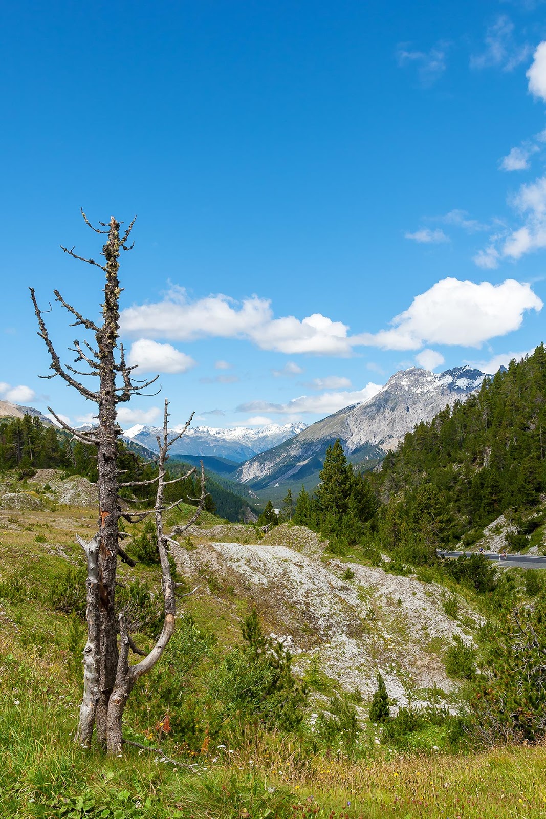
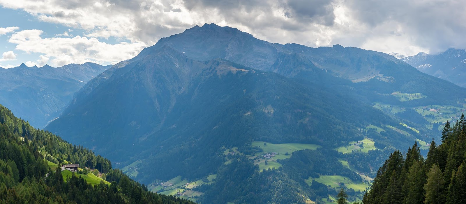
The Stilfserjoch from above
The tourists were out in force. Anxiously waiting to spoil the fun as
much as possible. Needless to say I took revenge on a few of them. Luckily the
view up to the top remained as impressive as ever with the road snaking its way
up the Northern side.

On the Stilfserjoch, between Kehre 21 and 20, Franzenshöhe (I)
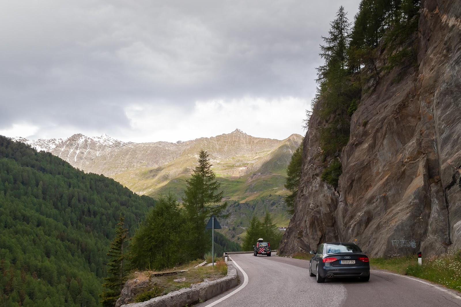
For the rest of the run up the Stelvio I can be very short, rather
uneventful, even boring in the dense traffic. Only the engine tried to liven it
up, by pretending to overheat a bit. But halfway up the temperature gauge’s
scale, it remembered that it was built to be reliable. At the very crowded top
I only slowed down briefly, enabling René to take a picture of the sign.

After which we quickly headed down the southern slope, where we stopped briefly
near the old Italian border post to re-enact a picture taken 8 years earlier
when we did the Stelvio with ‘t Kreng:

‘t Kreng near II Casa Cantoniera dello Stelvio, 3th July 2002

The same spot 8 years later, view over Val di Braulio

II Casa Cantoniera dello Stelvio, an abandoned roadman’s house
on the
southern flank of the Silfserjoch (I)
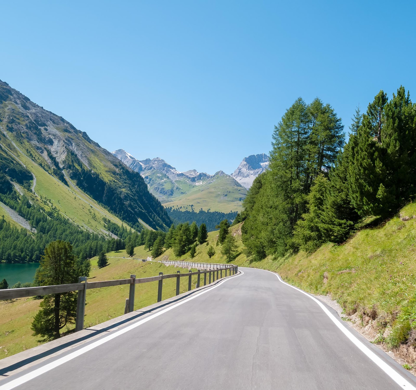
With the photo taken we continued with the descent which luckily was much less crowded
and thus more entertaining. So we made good time to the bottom off the pass from
where we headed west towards Livigno and Switzerland. But before we could enter
Switzerland, we first had to cross three more mountain passes, the Passo di
Foscagno, the Passo d'Eira and the Forcola di Livigno. After which we entered
Switzerland over the Bernina pass. As we still had quite a few miles to go till
we reached Thun, we pressed on. We opted for the “shortest” route over the
Albula pass, which turned out to be a very good choice indeed. As this pass
isn’t on one of the larger through roads, it is still fairly quiet and
unspoilt. But in true Swiss style the road itself is in mint condition, they
even went to some length in inventing an original/period way to prevent
speeding ...

Approaching the top, and the Albula Hospiz

A well deserved rest for
man and machine on top of the Albula pass

Gasthaus Albula, math
was not their forte 😜 (CH)
Only to be reminded of
the fact that Switzerland is not only very beautiful, but also very expensive
compared to its neighbours!. At least it was a good lunch. And with the lunch and
the discussion with the waitress over the bill finished, we headed down towards
Thun.
Approaching the Lai da
Palpuogna
But in between there
were some more great driving roads, and not only mountain passes, as the
Flimsersteintunnel illustrates. Actually the tunnel is an underground bypass of
the H19 around the village of Flims.

The Hauptstraße H19 underneath
Flims
or the Flimsersteintunnel
Although, due to the
sometimes spectacular views, the mountain passes impressed most. And probably
the best of them all was the Süstenpass ...

The Süstenpass from above
With beautiful flowing
corners and a smooth road surface. Sadly René was so impressed by the scenery,
that he forgot to take some more pictures from the navigator’s seat. Though
these three pictures do give a good impression of the lovely scenery.

In good company on top of the Süstenpass

View of the Steingletscher, just past the top of the Süstenpass

On the H11, approaching the Alpin Center Süstenpass (CH)
As it was by now nearly six o’clock in the evening we pressed on towards
our final destination for the day, the lake side town of Thun, situated at the
north-western shore of the Thunersee, which looked very nice in the early
evening sun.

The Thunersee, seen from the H6 running along its southern shore (CH)
In Thun we would meet up with fellow TR7 owner Thomas. I had phoned him
from the top of the Albula pass, to tell him that we probably would be much
later than originally planned. So to be sure that we wouldn’t have to sleep on
the floor he decided to book us a room in a nearby hotel, again thanks very
much for that. So as a reward for that we invited him for diner. Needless to
say that the remainder of the evening was spent on food, drinks and (mostly)
Triumph talk.
Day 6 (395 km)

The car waiting patiently in the parking
Gasthaus Rössli in Thun (CH)
Next day dawned quite early, and after a hearty breakfast we set of for
the German border town of Bad Säckingen some 25 kilometres east of Basel. But
not before I filled up the car with some decent 100 RON fuel. Was amazed to
find that with over 478 kilometres and 8 mountain passes the engine had
consumed only 46,5 litres of fuel. Very impressed with that.
We choose Bad Säckingen for the border crossing as there was no Motorway
heading there directly, thus making the navigating that much easier (we didn’t
buy a vignette, so had to keep of the motorways. I know thrifty Dutch 😝). But before we crossed into Germany we had a few hours of great flowing
country lanes ahead of us. What the scenery lacked in spectacular views was more
than compensated by the quality and layout of the roads. Fast road driving
indeed!

On the Siehenstrasse (229.4) near Schangnau (CH)
And despite a few navigational errors we reached the German border near Bad
Säckingen, just past noon.

Border post Bad Säckingen
From where we headed for the narrow Wehrtal and lots of other great
driving roads through the heart of the Schwarzwald (or Black Forest for the
non-German speakers J)

Bundesstraße B518 through the Wehrtal (D)
But all these lovely roads eventually took much more time than planned,
and by the end of the afternoon I called it a day. So instead of somewhere
north of Kaiserslautern, we found ourselves a nice hotel in the little town of
Appenweier, not far from Strasbourg, but still a fair distance from home. Here
we put the car to rest in a hotel parking for the last time. While we spent the
last night of the trip with some good local food and beer.

In the parking of Hotel Hanauer Hof
Day 7, going
home (532 km)
The last day turned out to be very much like the first one. Not really worth
remembering to long. While preparing to leave it started to rain, and this rain
followed us more or less all day. As we still had a fair amount of kilometres
ahead of us, we decided to use the Autobahn A5 till Karlsruhe. From here we switched
to the Bundesstraße B48 which we followed through a very wet Pfalzerwald to Kaiserslautern,
and from there towards Bernkastel-Kues for lunch.

Downpour on the Bundesstraße B48 through the Pfalzerwald
south of Kaiserslautern (D)
After lunch in one the many small villages along the shores of the Mosel
river, we headed toward Adenau, and the Nürburgring. We shouldn’t have done
that. Scarcely out of the Mosel valley we met some road works, with a very
un-German diversion. Yes of the variety that isn’t signposted correctly. As a
result of this we were running in circles! And in true Eifel style the downpour
began to liven it all up a bit. At least the hood once again proved to be pretty
much waterproof.
To cut a long story short we managed to find our way to the Nürburgring and
from there to the A1 and A61. Here the car again proved to be a very relaxed
long distance cruiser.

Ever more familiar roads, on the Autobahn A1 near Mechernich (D)
Relaxed motorway cruising
And home in the end. Sadly most of the road grime she collected over the
week was washed away in the Eifel downpour. So hardly any visible proof of the
many hard kilometres she had to endure!

Almost home
Boring statistics etc.
Total distance covered: 2825 kilometres;
Total fuel consumption: 265 litres;
Average fuel consumption: ±10.7 km/litre (or 30.2 mpg)
Looking back I have to admit that the car behaved pretty well, with
pretty good fuel economy! But there were some issues that spoiled the fun a
bit;
Firstly the grip of the Continental tyres is rather poor under braking
(in wet and dry conditions). Although this could be caused by the Mintex pads biting
to hard when cold?
And secondly not being able to rev the engine when needed was a bit of a
disappointment, especially on the passes. The little skirmish with the M3 on
the Jaufenpass clearly showed that the car can be quick and handles rather
nicely (although the tyres will start to screech pretty quickly). But again I have
a few small issues to sort in the coming weeks;
- Fit other tyres and only use these for sedate events;
- One side of the instrument lights stopped working (probably a loose or corroded contact);
- Speedo's needle bounces up and down wildly (probably caused by corroded contact inside the speedo);
- A slight water leak along the fuel filler cap surround;
- And of course the oil leak from the water pump.
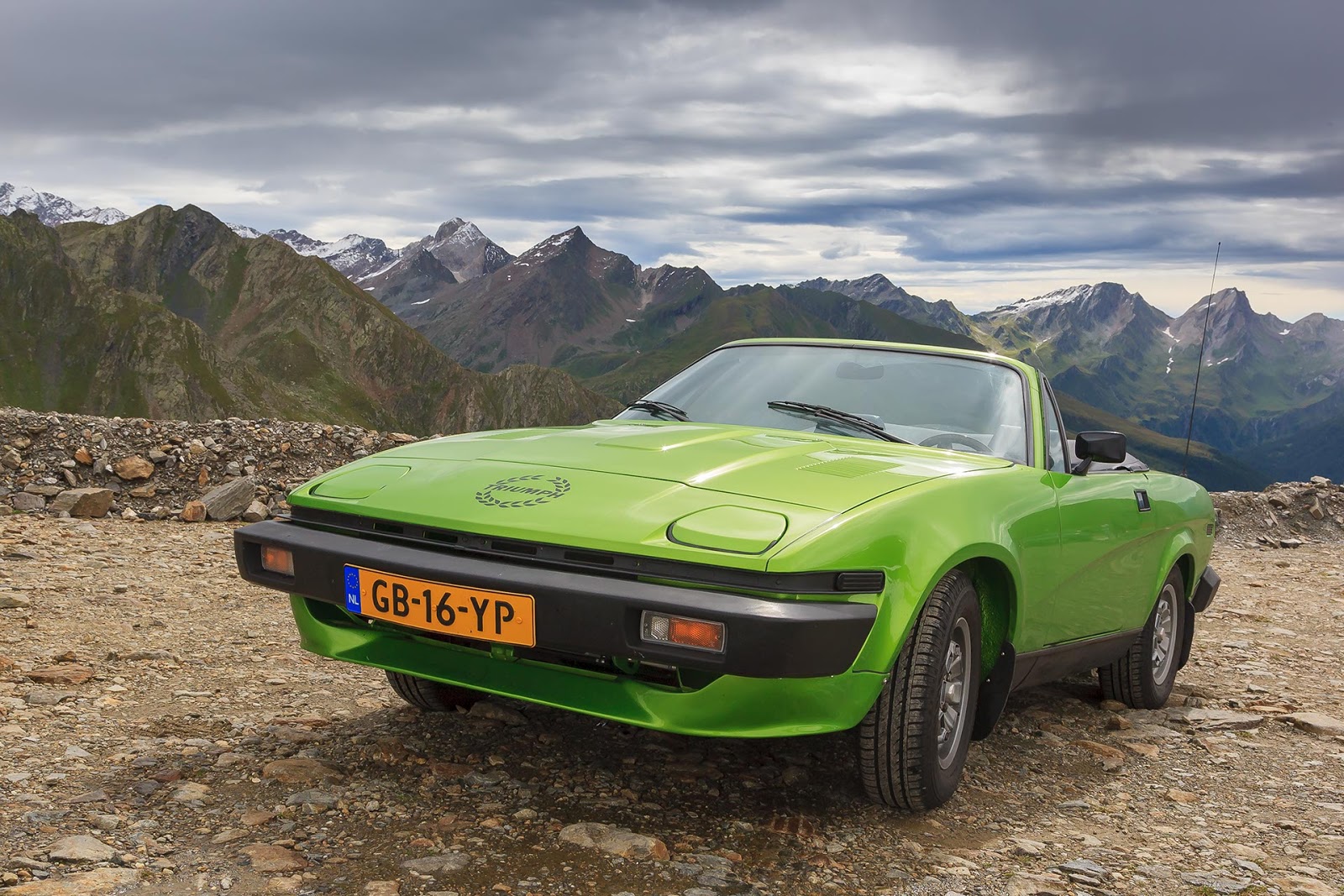
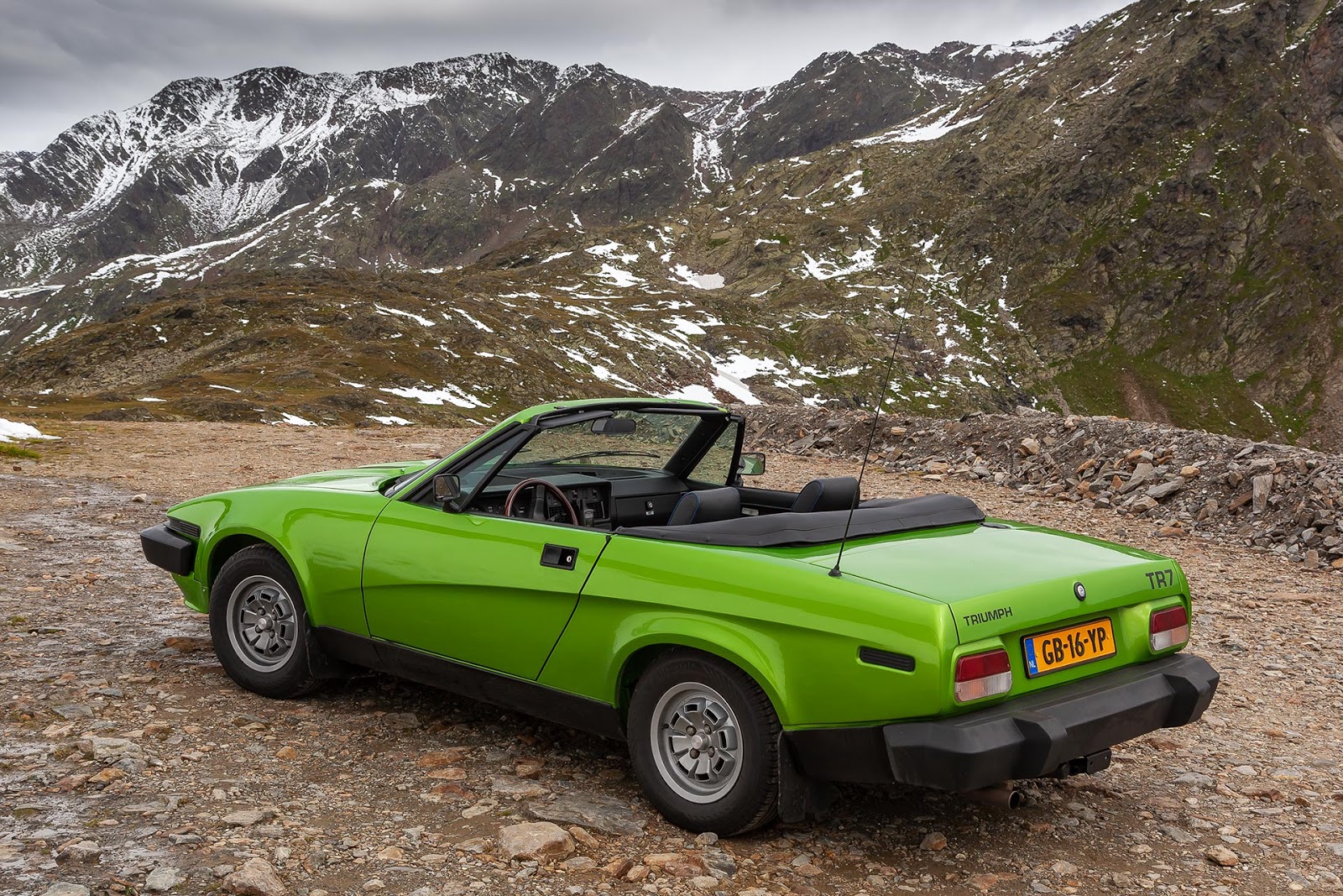
The Passes
And to finish this report a list
of all the passes I drove.
In driving order;
Fernpass (A) 1212m¹ ASL
Timmelsjoch (A/I) 2474m¹ ASL
Ofenpass (CH) 2149m¹ ASL
Martinsbrucker Straße (A) 1461m¹ ASL
Reschenpass (A/I) 1504m¹ ASL
Jaufenpass (I) 2094m¹ ASL
Timmelsjoch (A/I) 2474m¹ ASL
Penserjoch (I) 2211m¹ ASL
Jaufenpass (I) 2094m¹ ASL
Stilfserjoch (I) 2760m¹ ASL
Passo di Foscagno (I) 2261m¹ ASL
Passo d'Eira (I) 2208m¹ ASL
Forcola di Livigno (I) 2315m¹ ASL
Berninapass (CH) 2328m¹ ASL
Albulapass (CH) 2315m¹ ASL
Oberalppass (CH) 2044m¹ ASL
Süstenpass (CH) 2224m¹ ASL
Edited 8th
August 2020: As it is 10 years ago that I was touring the Alps,
for the “shake-down-tour” of my freshly restored DHC, I decided to freshen up
the pictures using the original digital “negatives”. Also added a few extra
pictures and edited the text where necessary.