Sunday, 6 October 2024

Two weeks hiking in South Tyrol


Shortly after returning from Club Triumph’s 10 Countries Run, I headed south into the mountains again. This time not for a driving, but for a walking holiday in my favourite area; the autonomous northern Italian province of South Tyrol. Time for the by now traditional photographic report of the various walks.

Day 1: Sankt Martin in Passeier – Sankt Leonhard
As in previous years we used the first few days to get used to walking in the steep terrain of the area, starting with a leisurely round walk from our hotel to the neighbouring village for lunch.

Public footpath marker to the ruins of the Jaufenburg,
Sankt Leonhard in Passeier.

Schmötzel, a farmstead directly underneath the ruins of the Jaufenburg,
Sankt Leonhard in Passeier.

Tearoom on the Kohlstatt in Sankt Leonhard in Passeier.

Floner, a typical farmstead on the slopes of the Passeiertal,
near Sankt Martin in Passeier

Mini self-service market belonging to the Floner farmstead.

Day 2: Sankt Martin in Passeier – Christl
The second day was also used to get into our stride.
So another fairly easy walk along the slopes of the Passeiertal

One of the many remembrance shrines in the area,
and a sober reminder of the dangers of the mountains.
Egger Sankt Martin in Passeier


Old farmstead, Egger Sankt Martin in Passeier

Day 3: Seeber Tal
A lovely walk through the secluded but always beautiful Seeber Tal.
Though there were some deep snow drifts left by the weekend's heavy snow fall

Parking area Seeber Alm

The Gurgler Kamm seen from the Seeber Alm

View across the Seeber Alm with the Timmelsjoch
and the Stubaier Alps in the background

On the Seeber Alm

Pointing the way around the Seeber See


The Obere Glaneggalm with the Gurgler Kamm in the background

Day 4: Faltmar Tal
A circular walk starting from Pfelders over the Karalm into the secluded Faltmartal

The flank of the Kreuzjoch seen from across the valley, Karalm Pfelderer Tal

Footbridge over the Pfelderer Bach, Bergkristall Moos

View along the Pfelderer Bach with some peaks of the Texel Gruppe in the background,
Hinterstein Pfelders

Day 5: Matatzspitze
Last year I aborted the ascend to the summit of the 2178m¹ high Matatzspitze overlooking Sankt Martin, because of the rather poor weather conditions. And rightly so! Luckily this year the weather conditions were much better, enabling us to reach the summit without any problems. It was well worth the effort!

View from the Ulfaser Alm on the Hohe Kreuzspitze and the Anger Mahder

View from the Matatzspitze. Looking south along the Passeier Tal towards Meran

View from the northern flank of the Matatzspitze over the northern part of the Passeier Tal
and the Jaufen Pass, with the Stubaier Alps in the background

In the woods above the Ulfaser Alm

Enjoying a well-deserved beer back at our hotel!

Day 6: Timmels Alm
A very nice but also rather demanding walk towards the „Große Timmler Schwarzsee“,
high up the Timmels Alm

Typical public footpath marker. Not brilliant when there is a lot of snow around!

Shelter overlooking the Oberkrumpwasser

The meanders of the Oberkrumpwasser and the source of the Passer River

The „Große Timmler Schwarzsee“ high up the Timmels Alm
 at an altitude of 2505 m¹ asl

View from the Timmels Alm towards the Seeber Tal and the Gurgler Kamm

Overlooking the Oberkrumpwasser from the Timmels Alm

Day 7: Sankt Martin in Passeier – Magdfeld
A local walk from our hotel into the Kalmtal towards the small hamlet of Magdfeld

Glamitz, another typical farmstead up the steep slopes of Kalmtal

One of many road crucifixes. This one being situated on a crossroads in the woods near Seeber, Kalmtal

The view from Gruber into the Passeier Tal
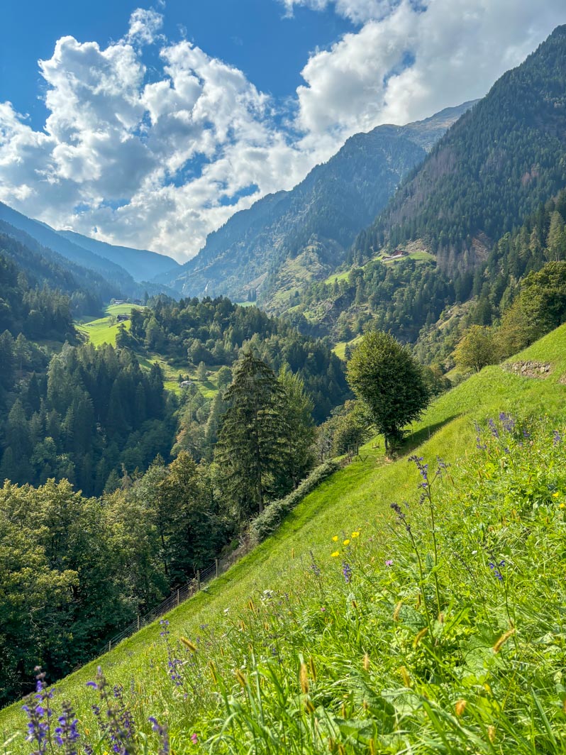
The view from Gruber into the Kalmtal

Day 8: A lazy Sunday in Sankt Martin in Passeier
It was party time in the village, as they celebrated the arrival of a new priest for their parish.
And one from the own village! So we decided on a lazy Sunday, enjoying the festivities

Hotel Pfandler Alm in Sankt Martin in Passeier

Garberweg Sankt Martin in Passeier

Open-air mass for the parishioners in the village square of Sankt Martin

It's always easy to find the musicians of a local “Muzikkapelle”, Gasthaus Lamm Mitterwirt!

The people of Sankt Martin gathering in the village square for the festive procession to the festival grounds

Die Musikkapelle von Sankt Martin in Passeier,
heading the procession towards the “Festwieße”

Day 9: Above the Zufrittsee
A circular walk along the head of the Martelltal and above the Zufrittsee

The “Zufall Hütte” towering over the head of the Martelltal

On the meadows “Paradies am Cevedale” above the Zufrittsee

View across the Zufrittsee

Day 10: Urweg Jaufenkamm
Walking part of the Urweg Jaufenkamm between the Römerkehre and the Glaitner Joch.
The views again were fantastic

Parking area near the Römerkehre, Jaufen Straße

Obscured by clouds. View across the Passeiertal from the Fleckneralm

A view from the Rinner Sattel, with the Waltental in the foreground,
and the Passeier Tal in the background obscured by clouds

On the Jaufenkamm between the Fasnachter and the Fleckner,
with the Ratschingstasl in the background

Spoilt for choice were to go to, Glaitner Joch

The Passeier Tal again obscured by clouds, Glaitner Joch

Day 11: Pfelderer Tal
A walk through the Pfelderer Tal, from Pfelders over the Karalm
and the Faltschnalalm towards Lazins and back to Pfelders.

The flank of the Kreuzjoch partially obscured by clouds.
Seen from across the valley, Karalm Pfelderer Tal

View across the Pfelderer Tal from the Panoramaweg

View across the Pfelderer Tal from the Faltschnalalm

Day 12: Meran
The weather forecast for this day had been rather wet all week so we decided to take the bus to the spa city of Meran. More tourists had the same idea, so it was rather crowded. And as this city has been extensively covered in previous posts the camera got an easy day!
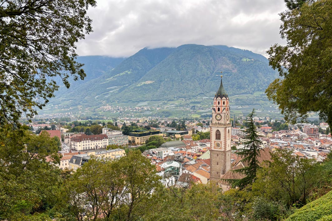
Overlooking Meran from the Tappeiner Promenade

Away from the rush in the small alleyways east of the much more crowded city centre,
Passeier Gasse Meran

Day 13: Sankt Martin in Passeier – Sankt Leonhard
The weather forecast for our final day was also rather wet. So the last walk was a leisurely affair to Sankt Leonhard for lunch. This way we would be back in our hotel with a few hours left to pack up everything for the journey home. It turned out the weather forecast was quite accurate at last, so the camera again didn’t see much action!

The Schildhof Steinhaus, a fortified farm house,
overlooking Sankt Martin in Passeier

The Jaufenkam and Sankt Leonhard in Passeier obscured by clouds,
Moar Sankt Martin in Passeier

Clouds drifting in towards the Jaufenkam, Moar Sankt Martin in Passeier

Gasthaus Lamm Mitterwirt
The restaurant where we spent most evenings. 
Good food & drinks and friendly staff. What more do you need!


Friday, 13 September 2024

Club Triumph’s 10 Countries Run 2024

Last Sunday I returned home from the 10th (official) edition of Club Triumph’s 10 Countries Run. And for the first time in 15 years I wasn’t doing it in my favourite car for the event. The story why that is, should be well known by now. Instead we used a friend’s TR7 V8. The event itself should, according to the roadbook, cover 2762 kilometres spread out over five days.

Setting of for the first stage to our hotel near the start of the event (2024-09-02 NL).

A short rest for (wo)man and machine on our way to Rouen.
On the Aire de Graincourt on the A2 near Havrincourt (2024-09-02 F).

Day 1 Incarville – Saint-Étienne (652 km)
The route would take us right across the heartland of France. Sadly though the first half of this stage was hampered by villages with lots of vicious speed bumps or traffic light regulated one way systems. So by the time we reached the more interesting driving roads south of Avallon we were already well behind on schedule. At least it was time for lunch, which we found in the small village of Quarré-les-Tombes.

Sadly not long after our lunch stop it started to rain again. Not extremely heavy, but more than enough to make the roads rather slippery. Not good with a powerful V8 under the bonnet. Long story short; we lost more time and reached our Hotel in Saint-Étienne well past seven ‘o clock in the evening. Time for a well-deserved beer!

The official start in the parking of the LeClerc Supermarket in Incarville
(2024-09-03 F)

Lunch stop in the Hotel du Nord in the picturesque village of Quarré-les-Tombes
(2024-09-03 F)

On the D38, entering the village of Neulise (2024-09-03 F)

What’s in a name. Nice local beer in the hotel bar in Sainte-Étienne
(2024-09-03 F)

Day 2 Saint-Étienne – Villars-Colmar (597 km)
After the first day we decided that the various day stages were rather over-ambitious. Time for a change of plan and route! For day 2 we opted for the more direct route towards our finish location north of Saint-André-les-Alpes. This way we were avoiding the long motorway stretches towards the Mediterranean. And we would be able to choose some rather nice driving roads. Plus it would shorten the driving time by a fair amount …

We started out from Saint-Étienne following the roadbook till we were about to hit the motorway South. From here we headed inland for a nice variation of lovely driving roads. Sadly though the final stretch of the day, the D908 over the Col d’Allos, was closed. So we had to take a detour along the D902/D22020 over the Col de la Cayolle and the D78/D278 over the Col des Champs. It was a lovely detour, certainly helped by the nice weather. And it did add some more time to another long day. But still enough time left for some food and a few beers.

Heading out of Sainte-Étienne over the M8 near the village of Planfoy
(2024-09-04 F)

On the D868/D1, crossing the river Rhône from Andance towards Andancette
(2024-09-04 F)

On the D93 heading towards the small town of Die and the mountains
(2024-09-04 F)

A tight fit. The Chemin de la Recluse (or the D238) through the small town of Die
(2024-09-04 F)


The D93 passing through a rocky chaos called Le Claps
(2024-09-04 F)


On the D902 heading towards the top of the Col de la Cayolle
(2024-09-04 F)

On the D2202 on the top of the Col de la Cayolle
(2024-09-04 F)

Day 3 Villars-Colmar – Lesa (444 km)
Choosing a hotel in Villars-Colmar for our overnight stay seemed like a good idea when it was booked. Shortening the stage by nearly half an hour. But it turned out we would be doing both the Col des Champs and the Col de la Cayolle again. As we had already done them the day before, and the weather conditions were rather poor in the area on day 3, we decided on an alternative:
The long way round! Heading south from Villars-Colmar towards Saint-André-les-Alpes, then onto the N202 towards Barrême, the N85 to Digne-les-Bains and finally the D900 to Barcelonette. According to the satnav that would add around 30 minutes to our travel time. But the roads would be much faster. And the weather also turned out to be much better on the alternative route. And the theory was proofed correct by a few cars we saw earlier while heading south. And we passed these cars again in Barcelonette (F). But now we were back on the route and we were heading in the same direction.

We followed the official route till Demonte (I). Here the official route would turn left from the SS21 towards the SP268 for a loop through the mountains. As the ETA for our hotel in Lesa was rather late we decided to skip the twisty bits and headed straight on. I should have reprogrammed the satnav at this point. But I thought it would soon recalculate a new route. It didn’t and kept going back to the junction in Demonte. In the end I had to reset it, before programming the quickest route towards our hotel in Lesa. Let’s say we got there in the end!

On the N202 in Barrême (2024-09-05 F)

Lunch stop along the SS21 on the out skirts of Demonte
(2024-09-05 I)

On the SS21 in the centre of Demonte (2024-09-05 I)


Along the shores of the Lago Maggiore in Meina (2024-09-05 I)

The Via Correnti in Lesa, seen from the balcony of our hotel (2024-09-05 I)

View across the Lago Maggiore towards Arona,
from the roof top terrace of our hotel in Lesa (2024-09-05 I)

The car lingering in the parking lot of our lakeside hotel in Lesa (2024-09-05 I)

Day 4 Lesa - Singen: 515 km
This was another stage that looked quite challenging timewise, with 515 kilometres of mostly mountainous roads and a calculated driving time of nearly 10 hours. First the route followed the shores of the Lago Maggiore, soon to head onto the motorway towards Switzerland and the Simplonpass. All very nice safe for the fact that the Swiss had decided they could do even better. Meaning lots of roadworks!

Luckily right from the start it was decided that we would use two “escape” points. Depending on the time we arrived there we would decide whether to carry on or take a shortcut. Well that turned out to be easy! Coming down the Furkapass we stopped for lunch. It was well past one ‘o clock, with an ETA in Singen (D) around eight ‘o clock in the evening. So after lunch I programmed the satnav for the quickest route to our hotel in Singen, but avoiding motorways (no vignette). Leaving the official route in Altdorf. First part of the alternative route was a rather pleasant drive. But later in the afternoon we hit dense rush hour traffic, which slowed us down considerably. But we arrived in Singen in time for food and beer.

Early morning fluid level checks in the hotel’s car park in Lesa
(2024-09-06 I)

The Grimselpass seen from the Furkastraße near Oberwald
(2024-09-06 CH)

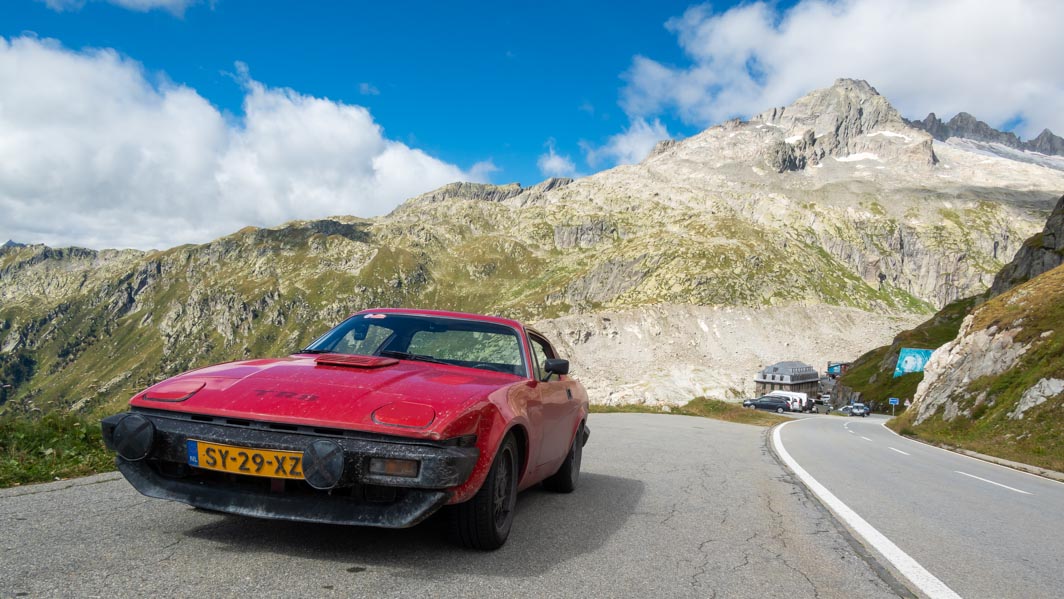
Chasing one of the three entered Vermillion Dolomite Sprints over the Furkastraße.
The famous Hotel Belvédère can be seen in the distance, to the right of the traffic sign
(2024-09-06 CH)


The Grimselpass seen from the Furkastraße,
a short distance away from Hotel Belvédère (2024-09-06 CH)

Coming down the northern slope of the Furkapass near Realp
(2024-09-06 CH)

On the Hauptstraße 8 near Feusisberg, with the Zürichsee in the background
(2024-09-06 CH)
Enjoying a few beers and food outside “Zur Sonne” in Singen
(2024-09-06 D)

Day 5 Singen – Kerkrade: 554 km
The final day, and traditionally a pretty long drive distance wise. But with the route “only” 554 kilometres long according to the roadbook, we decided to follow this as much as possible. It was a nice drive with a good mix of different road types; motorways to get miles done quickly and flowing country lanes to enjoy the driving. The route for the final day again covered 5 countries; Germany, France, Luxembourg, Belgium and The Netherlands.

The start of the final day, and some of the participants seen
passing by from our hotel room in Singen (2024-09-07 D)

Chasing the Hurricane over the Länderstraße L170 near Büschdorf
(2024-09-07 D)

And there were refuelling stops. Lots of them!

Varennes-sous-Dun (2024-09-03 F)

Pont-de-l'Isère (2024-09-04 F)

Villars-Colmar (2024-09-04 F)

E70 Autostrade dei Vini Crocetta (2024-09-05 I)

Larochette (2024-09-07 L)

Sunday, 1 September 2024

’t Kreng’s cooling system


Over the past few weeks I have been able to take ‘t Kreng out for a few short circa 100 kilometre drives. All to see how the coolant system developed with some regular use. The first two tours were not encouraging. The temperature gauge was rather erratic, with the needle constantly moving around. Though it never went over the ½ mark, it wasn’t very confidence inspiring! It might point to a small coolant leak or pressure loss. But it might as well be an electric problem. Also the low coolant level would light up when stopping at traffic lights. That could be explained by the slightly low coolant level, combined with some oxidation on the coolant level probe and the lower voltage when idling.


But first things first; checking for leaks again. And sure enough there were some traces of coolant visible on the radiator.


Luckily no visible leaks from the radiator itself, just some coolant hoses that could again be tightened a little (I have a tendency to tighten them only as much as is necessary to prevent damage to the ageing hoses). And a fair amount of roadkill on the front of the radiator!


And with that done I got in the car yesterday to drive over to a friend’s workshop to help with a problem with our car of choice for Club Triumph’s 10 Countries Run that starts Tuesday morning. This time the temperature gauge went up till the needle touched the ½ mark. And there it remained. Result! But during the outward journey the low coolant level light would lite up every time I had to stop at a traffic light. But the temperature gauge’s needle wouldn’t move.

And while going home via a long detour, after the work was finished, everything went quiet well. The temperature again stayed constant and the low coolant level light only came on ones, when negotiating a fairly tight and long 180° right hand corner at considerable speed! Hopefully all she needs now is a little top up of the coolant system. Time will tell. But first Club Triumph’s 10 Countries Run!