Last
Sunday I returned home from the 10th (official) edition of Club Triumph’s 10
Countries Run. And for the first time in 15 years I wasn’t doing it in my
favourite car for the event. The story why that is, should be well known by
now. Instead we used a friend’s TR7 V8. The event itself should, according to
the roadbook, cover 2762 kilometres spread out over five days.

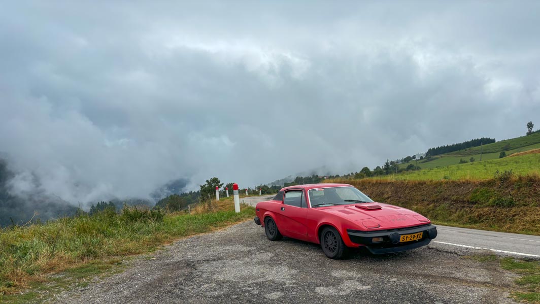
Setting of for the first stage to our hotel near the start of the event (2024-09-02 NL).

A short rest for (wo)man and machine on our way to Rouen.
On the Aire de Graincourt on the A2 near Havrincourt (2024-09-02 F).
Day 1 Incarville – Saint-Étienne (652 km)
The route would take us right across the heartland of France. Sadly though the first half of this stage was hampered by villages with lots of vicious speed bumps or traffic light regulated one way systems. So by the time we reached the more interesting driving roads south of Avallon we were already well behind on schedule. At least it was time for lunch, which we found in the small village of Quarré-les-Tombes.
Sadly not long after our lunch stop it started to rain again. Not extremely heavy, but more than enough to make the roads rather slippery. Not good with a powerful V8 under the bonnet. Long story short; we lost more time and reached our Hotel in Saint-Étienne well past seven ‘o clock in the evening. Time for a well-deserved beer!

(2024-09-03 F)

(2024-09-03 F)

On the D38, entering the village of Neulise (2024-09-03 F)

What’s in a name. Nice local beer in the hotel bar in Sainte-Étienne
(2024-09-03 F)
Day 2 Saint-Étienne – Villars-Colmar (597 km)
After the first day we decided that the various day stages were rather over-ambitious. Time for a change of plan and route! For day 2 we opted for the more direct route towards our finish location north of Saint-André-les-Alpes. This way we were avoiding the long motorway stretches towards the Mediterranean. And we would be able to choose some rather nice driving roads. Plus it would shorten the driving time by a fair amount …
We started out from Saint-Étienne following the roadbook till we were about to hit the motorway South. From here we headed inland for a nice variation of lovely driving roads. Sadly though the final stretch of the day, the D908 over the Col d’Allos, was closed. So we had to take a detour along the D902/D22020 over the Col de la Cayolle and the D78/D278 over the Col des Champs. It was a lovely detour, certainly helped by the nice weather. And it did add some more time to another long day. But still enough time left for some food and a few beers.
Heading out of Sainte-Étienne over the M8 near the village of Planfoy
(2024-09-04 F)

On the D868/D1, crossing the river Rhône from Andance towards Andancette
(2024-09-04 F)

On the D93 heading towards the small town of Die and the mountains
(2024-09-04 F)

A tight fit. The Chemin de la Recluse (or the D238) through the small town of Die
(2024-09-04 F)


The D93 passing through a rocky chaos called Le Claps
(2024-09-04 F)


On the D902 heading towards the top of the Col de la Cayolle
(2024-09-04 F)

On the D2202 on the top of the Col de la Cayolle
(2024-09-04 F)
Day 3 Villars-Colmar – Lesa (444 km)
Choosing a hotel in Villars-Colmar for our overnight stay seemed like a good idea when it was booked. Shortening the stage by nearly half an hour. But it turned out we would be doing both the Col des Champs and the Col de la Cayolle again. As we had already done them the day before, and the weather conditions were rather poor in the area on day 3, we decided on an alternative:
The long way round! Heading south from Villars-Colmar towards Saint-André-les-Alpes, then onto the N202 towards Barrême, the N85 to Digne-les-Bains and finally the D900 to Barcelonette. According to the satnav that would add around 30 minutes to our travel time. But the roads would be much faster. And the weather also turned out to be much better on the alternative route. And the theory was proofed correct by a few cars we saw earlier while heading south. And we passed these cars again in Barcelonette (F). But now we were back on the route and we were heading in the same direction.
We followed the official route till Demonte (I). Here the official route would turn left from the SS21 towards the SP268 for a loop through the mountains. As the ETA for our hotel in Lesa was rather late we decided to skip the twisty bits and headed straight on. I should have reprogrammed the satnav at this point. But I thought it would soon recalculate a new route. It didn’t and kept going back to the junction in Demonte. In the end I had to reset it, before programming the quickest route towards our hotel in Lesa. Let’s say we got there in the end!

On the N202 in Barrême (2024-09-05 F)

Lunch stop along the SS21 on the out skirts of Demonte
(2024-09-05 I)

On the SS21 in the centre of Demonte (2024-09-05 I)


Along the shores of the Lago Maggiore in Meina (2024-09-05 I)

The Via Correnti in Lesa, seen from the balcony of our hotel (2024-09-05 I)

View across the Lago Maggiore towards Arona,
from the roof top terrace of our hotel in Lesa (2024-09-05 I)

The car lingering in the parking lot of our lakeside hotel in Lesa (2024-09-05 I)
Day 4 Lesa - Singen: 515 km
This was another stage that looked quite challenging timewise, with 515 kilometres of mostly mountainous roads and a calculated driving time of nearly 10 hours. First the route followed the shores of the Lago Maggiore, soon to head onto the motorway towards Switzerland and the Simplonpass. All very nice safe for the fact that the Swiss had decided they could do even better. Meaning lots of roadworks!
Luckily right from the start it was decided that we would use two “escape” points. Depending on the time we arrived there we would decide whether to carry on or take a shortcut. Well that turned out to be easy! Coming down the Furkapass we stopped for lunch. It was well past one ‘o clock, with an ETA in Singen (D) around eight ‘o clock in the evening. So after lunch I programmed the satnav for the quickest route to our hotel in Singen, but avoiding motorways (no vignette). Leaving the official route in Altdorf. First part of the alternative route was a rather pleasant drive. But later in the afternoon we hit dense rush hour traffic, which slowed us down considerably. But we arrived in Singen in time for food and beer.

Early morning fluid level checks in the hotel’s car park in Lesa
(2024-09-06 I)

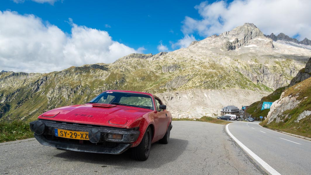
The Grimselpass seen from the Furkastraße near Oberwald
(2024-09-06 CH)

The famous Hotel Belvédère can be seen in the distance, to the right of the traffic sign
(2024-09-06 CH)


The Grimselpass seen from the Furkastraße,
a short distance away from Hotel Belvédère (2024-09-06 CH)

Coming down the northern slope of the Furkapass near Realp
(2024-09-06 CH)

(2024-09-06 CH)


Enjoying a few beers and food outside “Zur Sonne” in Singen
(2024-09-06 D)
Day 5 Singen – Kerkrade: 554 km
The final day, and traditionally a pretty long drive distance wise. But with the route “only” 554 kilometres long according to the roadbook, we decided to follow this as much as possible. It was a nice drive with a good mix of different road types; motorways to get miles done quickly and flowing country lanes to enjoy the driving. The route for the final day again covered 5 countries; Germany, France, Luxembourg, Belgium and The Netherlands.

The start of the final day, and some of the participants seen
passing by from our hotel room in Singen (2024-09-07 D)

Chasing the Hurricane over the Länderstraße L170 near Büschdorf
(2024-09-07 D)
And there were refuelling stops. Lots of them!

Varennes-sous-Dun (2024-09-03 F)

Pont-de-l'Isère (2024-09-04 F)

Villars-Colmar (2024-09-04 F)

E70 Autostrade dei Vini Crocetta (2024-09-05 I)

Larochette (2024-09-07 L)


